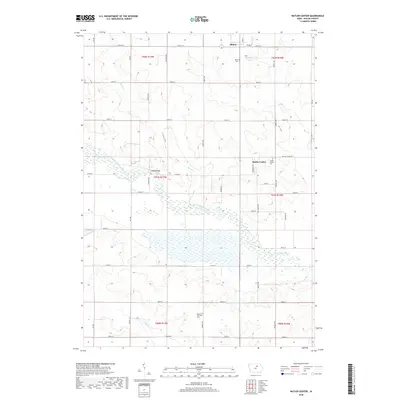
2018 Map of Butler Center
USGS Topo · Published 2018About this map
The West Fork Cedar River meanders across this Butler County landscape, creating a broad wetland corridor that defines the central geography of the area. To the north, the town of Allison serves as a primary hub, while the smaller settlement of Butler Center remains a significant point of interest for local historians. The map documents a meticulously surveyed grid of section lines and county roads, including Co Rd 51 and Butler Center Rd, which connect scattered farmsteads and agricultural plots. Genealogists will find the locations of Allison Cem, Butler Center Cem, and Monroe Township Cem particularly useful for tracing family roots in the region. The drainage patterns are further detailed by Kilson Creek and Johnson Creek, which feed into the main river valley, while Mead Bridge provides a specific crossing point over the West Fork.
Find a feature on this map
43 named features on this map. Tap any name to fly to it.
Don’t see what you’re looking for? This feature index may not catch every label — zoom into the map to look around manually.
Map Details
Editions of this 2018 Butler Center Map
This is the sole edition of this map. No revisions or reprints were ever made.
Other maps of this area

1954 · Waterloo
USGS Topo · 1:250,000

1955 · Waterloo
USGS Topo · 1:250,000

1971 · Coster
USGS Topo · 1:24,000

1971 · Clarksville
USGS Topo · 1:24,000

1971 · Stout
USGS Topo · 1:24,000

1972 · Dumont North
USGS Topo · 1:24,000

1972 · Allison
USGS Topo · 1:24,000

1979 · Dumont South
USGS Topo · 1:24,000

1979 · Butler Center
USGS Topo · 1:24,000

1980 · Aplington
USGS Topo · 1:24,000