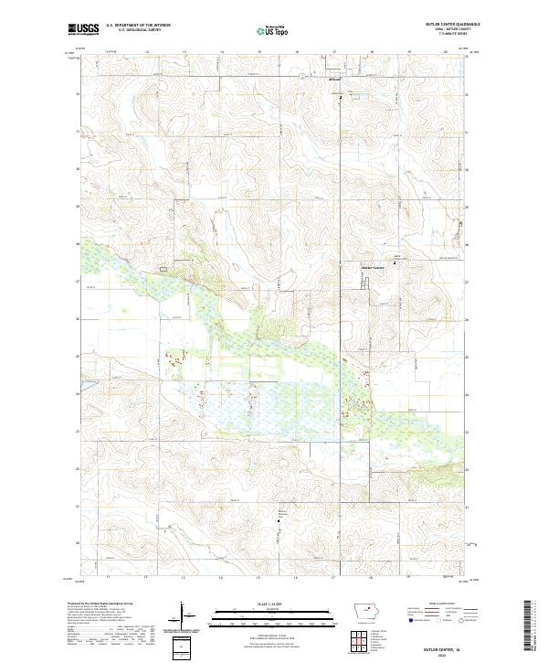
2022 Map of Butler Center
USGS Topo · Published 2022About this map
Butler Center sits as a primary point of interest in this section of central Butler County, positioned just south of Allison. The landscape is defined by the broad, meandering course of the West Fork Cedar River, which creates a wide riparian corridor across the center of the sheet. This area illustrates the classic Iowa township-and-range grid, where a network of gravel and paved roads like Jay Ave and Liberty Ave intersect the prairie landscape at regular intervals.
Find a feature on this map
42 named features on this map. Tap any name to fly to it.
Don’t see what you’re looking for? This feature index may not catch every label — zoom into the map to look around manually.
Map Details
Editions of this 2022 Butler Center Map
This is the sole edition of this map. No revisions or reprints were ever made.
Other maps of this area

1954 · Waterloo
USGS Topo · 1:250,000

1955 · Waterloo
USGS Topo · 1:250,000

1971 · Coster
USGS Topo · 1:24,000

1971 · Clarksville
USGS Topo · 1:24,000

1971 · Stout
USGS Topo · 1:24,000

1972 · Dumont North
USGS Topo · 1:24,000

1972 · Allison
USGS Topo · 1:24,000

1979 · Dumont South
USGS Topo · 1:24,000

1979 · Butler Center
USGS Topo · 1:24,000

1980 · Aplington
USGS Topo · 1:24,000