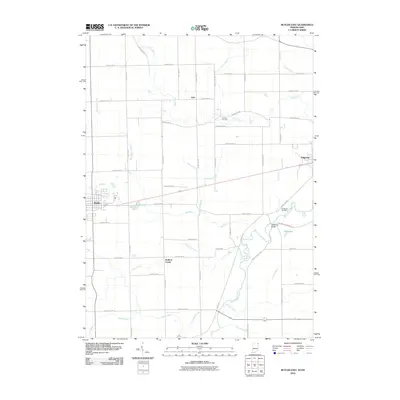
2010 Map of Butler East
USGS Topo · Published 2010About this map
Butler anchors the western edge of this landscape, where the flat agricultural plains of DeKalb County meet the meandering path of the Saint Joseph River. The terrain is defined by an extensive network of drainage infrastructure, including the Ziegler Ditch, Prouty Ditch, and Christoffel Ditch, which support the productive farmland of the region. Small rural nodes like Stafford Center and Artic represent the localized settlement patterns of northeastern Indiana, while the eastern border transitions toward Edgerton. Genealogists will find notable burial grounds such as Farnham Cemetery and Clarksville Cemetery near the river's bend. The area around Ladd Lake and the confluence of Big Run with the river highlights the natural hydrology that persisted despite the engineered water ways. The presence of Clarksville Bridge serves as a key crossing point in a landscape otherwise dominated by a rigid grid of county roads and family-named drainage channels like Walters Ditch and Ayford Ditch.
Find a feature on this map
63 named features on this map. Tap any name to fly to it.
Don’t see what you’re looking for? This feature index may not catch every label — zoom into the map to look around manually.
Map Details
Editions of this 2010 Butler East Map
This is the sole edition of this map. No revisions or reprints were ever made.
Other maps of this area

1914 · Pioneer
USGS Topo · 1:62,500

1914 · Bryan
USGS Topo · 1:62,500

1939 · Hamilton
USGS Topo · 1:24,000

1940 · Metz
USGS Topo · 1:24,000

1943 · Bryan
USGS Topo · 1:62,500

1944 · Pioneer
USGS Topo · 1:62,500

1948 · Hamilton
USGS Topo · 1:24,000

1953 · Fort Wayne
USGS Topo · 1:250,000

1956 · Fort Wayne
USGS Topo · 1:250,000

1958 · Hicksville
USGS Topo · 1:24,000