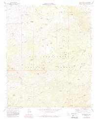
1971 Map of Butler Peak
USGS Topo · Published 1988About this map
San Bernardino National Forest encompasses this high-elevation terrain, dominated by prominent peaks and a network of historic resource extraction sites. The landscape is defined by massive formations like White Mountain, Butler Peak, and Shay Mountain, while the presence of the Balanced Rock Mine and Liberty Mine highlights the area's prospecting history. Smaller localized operations and numerous prospects are scattered across the slopes, particularly near Arrastre Canyon and Dawn o' Day Canyon.
Find a feature on this map
79 named features on this map. Tap any name to fly to it.
Don’t see what you’re looking for? This feature index may not catch every label — zoom into the map to look around manually.
Map Details
Editions of this 1971 Butler Peak Map
2 editions found
Other maps of this area

1899 · Redlands
USGS Topo · 1:62,500

1901 · Southern California Sheet No. 1
USGS Topo · 1:250,000

1901 · Redlands
USGS Topo · 1:62,500

1902 · Deep Creek
USGS Topo · 1:62,500

1902 · San Gorgonio
USGS Topo · 1:125,000

1904 · Southern California Sheet No. 1
USGS Topo · 1:250,000

1947 · Lucerne Valley
USGS Topo · 1:62,500

1949 · Lucerne Valley
USGS Topo · 1:62,500

1953 · San Bernardino
USGS Topo · 1:250,000
1953 · Harrison Mtn.
USGS Topo · 1:24,000