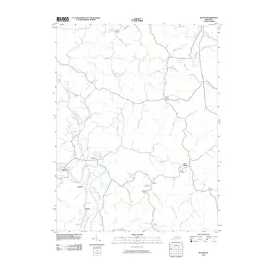
2010 Map of Butler
USGS Topo · Published 2010About this map
The Licking River winds through this northern Kentucky landscape, anchoring the town of Butler and the nearby settlements of Boston and Meridian. This early 21st-century survey documents the area's transition between river-valley agriculture and the upland communities of Mount Auburn and Peach Grove. Genealogists will find a high density of rural burial grounds, including the Butler Cemetery, Norris Cemetery, and Pleasant Hill Cemetery, many of which sit near established country crossroads like Kohler. The terrain is defined by a network of creeks such as Flour Creek, Twelvemile Creek, and Stepstone Creek, which carve through the ridges connected by local thoroughfares like Hogback Ridge Rd. The map illustrates how historic settlement patterns persist along the watercourses, with farmsteads and rural homes distributed along family-named routes such as Mc Garvey Rd and Reis Ridge Rd.
Find a feature on this map
63 named features on this map. Tap any name to fly to it.
Don’t see what you’re looking for? This feature index may not catch every label — zoom into the map to look around manually.
Map Details
Editions of this 2010 Butler Map
This is the sole edition of this map. No revisions or reprints were ever made.
Other maps of this area

1929 · Alexandria
USGS Topo · 1:48,000

1930 · Falmouth
USGS Topo · 1:48,000

1931 · Felicity
USGS Topo · 1:62,500

1936 · Alexandria
USGS Topo · 1:62,500

1936 · Falmouth
USGS Topo · 1:62,500

1952 · Berlin
USGS Topo · 1:24,000

1953 · Laurel
USGS Topo · 1:24,000

1953 · Butler
USGS Topo · 1:24,000

1953 · New Richmond
USGS Topo · 1:24,000
1953 · De Mossville
USGS Topo · 1:24,000