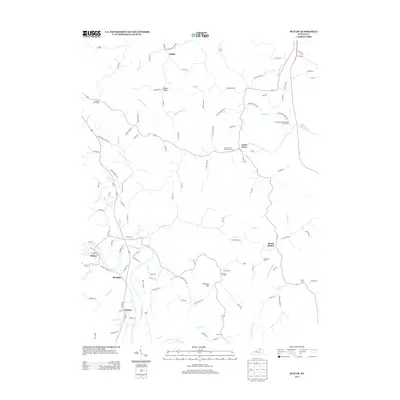
2013 Map of Butler
USGS Topo · Published 2013About this map
The Licking River winds through this Pendleton County landscape, anchoring the community of Butler and the nearby settlement of Boston. The terrain is defined by its numerous watercourses and elevated ridges, such as Fisher Ridge and Deer Lick, which have shaped local roads and property lines for generations. This 2013 survey provides a clear view of the area's rural character, showing a network of ridge-top roads like Reis Ridge Rd and Haubner Rd that connect dispersed hamlets and homesteads.
Find a feature on this map
115 named features on this map. Tap any name to fly to it.
Don’t see what you’re looking for? This feature index may not catch every label — zoom into the map to look around manually.
Map Details
Editions of this 2013 Butler Map
This is the sole edition of this map. No revisions or reprints were ever made.
Other maps of this area

1929 · Alexandria
USGS Topo · 1:48,000

1930 · Falmouth
USGS Topo · 1:48,000

1931 · Felicity
USGS Topo · 1:62,500

1936 · Alexandria
USGS Topo · 1:62,500

1936 · Falmouth
USGS Topo · 1:62,500

1952 · Berlin
USGS Topo · 1:24,000

1953 · Laurel
USGS Topo · 1:24,000

1953 · Butler
USGS Topo · 1:24,000

1953 · New Richmond
USGS Topo · 1:24,000
1953 · De Mossville
USGS Topo · 1:24,000