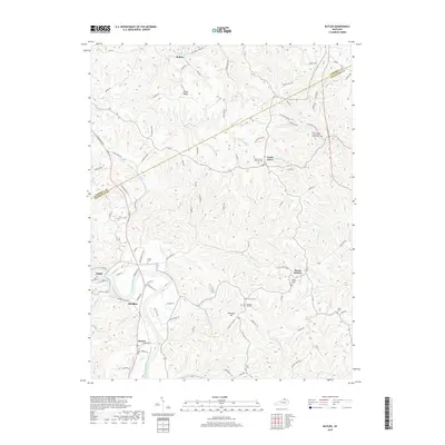
2019 Map of Butler
USGS Topo · Published 2019About this map
The Licking River winds along the western edge of this Kentucky landscape, serving as a primary geographical anchor for the communities of Butler and Meridian. The terrain is defined by a dense network of ridges and hollows, including Fisher Ridge and the heights around Pleasant Hill, which dictate the winding paths of rural routes like California Cross Rd and SirY Rd. This 2019 survey documents a landscape where small rural settlements remain tied to their ancestral grounds, evidenced by the high density of family and church-affiliated burial sites.
Find a feature on this map
99 named features on this map. Tap any name to fly to it.
Don’t see what you’re looking for? This feature index may not catch every label — zoom into the map to look around manually.
Map Details
Editions of this 2019 Butler Map
This is the sole edition of this map. No revisions or reprints were ever made.
Other maps of this area

1929 · Alexandria
USGS Topo · 1:48,000

1930 · Falmouth
USGS Topo · 1:48,000

1931 · Felicity
USGS Topo · 1:62,500

1936 · Alexandria
USGS Topo · 1:62,500

1936 · Falmouth
USGS Topo · 1:62,500

1952 · Berlin
USGS Topo · 1:24,000

1953 · Laurel
USGS Topo · 1:24,000

1953 · Butler
USGS Topo · 1:24,000

1953 · New Richmond
USGS Topo · 1:24,000
1953 · De Mossville
USGS Topo · 1:24,000