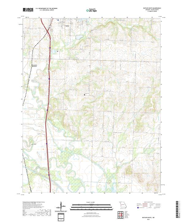
2021 Map of Butler South
USGS Topo · Published 2021About this map
Butler anchors the northern edge of this Bates County landscape, where the town’s residential streets like S Main St and S Orange St give way to the agricultural expanses of western Missouri. The terrain is defined by a sophisticated system of water management, visible in the straight lines of the Miami Drainage Ditch and the Bates County Drainage Ditch which channel flow through the lowlands surrounding the winding Marais des Cygnes River. These engineering features reflect the region's long-standing effort to reclaim fertile bottomlands for farming near Negro Bend. To the east of Monteith Junction, the landscape is dotted with smaller water bodies such as Kennedy Lake and Christy Lake, while family-named landmarks and local history are preserved at the centrally located Fairview Cem. A network of rural routes, including Cty Rd 1004 and various numbered SE roads, connects isolated farmsteads across the undulating prairies.
Find a feature on this map
64 named features on this map. Tap any name to fly to it.
Don’t see what you’re looking for? This feature index may not catch every label — zoom into the map to look around manually.
Map Details
Editions of this 2021 Butler South Map
This is the sole edition of this map. No revisions or reprints were ever made.
Other maps of this area

1887 · Butler
USGS Topo · 1:125,000

1894 · Butler
USGS Topo · 1:125,000

1934 · Papinsville
USGS Topo · 1:24,000

1936 · Rich Hill
USGS Topo · 1:24,000

1937 · New Home
USGS Topo · 1:24,000
1942 · Sprague
USGS Topo · 1:24,000

1947 · Lawrence
USGS Topo · 1:250,000

1950 · Lawrence
USGS Topo · 1:250,000
1955 · Rich Hill
USGS Topo · 1:24,000

1956 · Lawrence
USGS Topo · 1:250,000