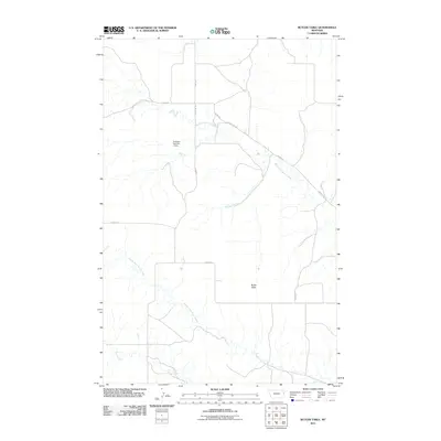
2011 Map of Butler Table
USGS Topo · Published 2011About this map
Butler Table rises as a prominent landform in this portion of eastern Montana, shaping the drainage patterns of the surrounding prairie. The landscape is defined by the headwaters of the Burns Creek system, including North Fork Burns Creek, Middle Fork Burns Creek, and the main stem of Burns Creek. These seasonal watercourses and their tributaries, such as McCone Creek, create a dissected terrain typical of the region's high plains. Human impact on the land is reflected in the network of rural routes like Road 531 and County Rd 325, which follow the natural contours and section lines. The Huffman Number 1 Dam stands as a specific marker of water management in this arid environment, providing a focal point for local land use and ranching infrastructure within the drainage basin.
Find a feature on this map
13 named features on this map. Tap any name to fly to it.
Don’t see what you’re looking for? This feature index may not catch every label — zoom into the map to look around manually.
Map Details
Editions of this 2011 Butler Table Map
This is the sole edition of this map. No revisions or reprints were ever made.
Other maps of this area

1909 · Glendive
USGS Topo · 1:250,000

1954 · Glendive
USGS Topo · 1:250,000

1957 · Glendive
USGS Topo · 1:250,000

1958 · Glendive
USGS Topo · 1:250,000

1966 · Intake NW
USGS Topo · 1:24,000

1966 · Allard Ranch
USGS Topo · 1:24,000

1972 · Red Top
USGS Topo · 1:24,000

1972 · Butler Table
USGS Topo · 1:24,000

1972 · Fox Lake
USGS Topo · 1:24,000

1972 · Enid SE
USGS Topo · 1:24,000