
1972 Map of Fox Lake
USGS Topo · Published 1975About this map
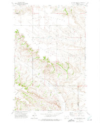
Fox Lake dominates the central landscape of this Richland County expanse, serving as a focal point for the surrounding prairie terrain. The Burlington Northern railroad corridor runs along the northern shore of the lake, paralleling Fox Creek as it winds through the township lines of the High Plains. This 1970s survey captures the industrial infrastructure of the era, marked by a significant Pipeline cutting across the southern sections and numerous scattered sites labeled Well, indicating the region's energy and water resource management. The map provides a precise look at the section lines and rural land divisions characteristic of eastern Montana, where the transport of goods by rail and the presence of utility corridors dictated the local geography.
Find a feature on this map
5 named features on this map. Tap any name to fly to it.
Don’t see what you’re looking for? This feature index may not catch every label — zoom into the map to look around manually.
Map Details
Editions of this 1972 Fox Lake Map
This is the sole edition of this map. No revisions or reprints were ever made.
Other maps of this area

1909 · Glendive
USGS Topo · 1:250,000

1954 · Glendive
USGS Topo · 1:250,000

1957 · Glendive
USGS Topo · 1:250,000

1958 · Glendive
USGS Topo · 1:250,000

1972 · Butler Table
USGS Topo · 1:24,000

1972 · Enid SE
USGS Topo · 1:24,000

1972 · Lambert
USGS Topo · 1:24,000
1972 · Mc Cone Heights
USGS Topo · 1:24,000

1972 · Enid
USGS Topo · 1:24,000

1981 · Sidney
USGS Topo · 1:100,000