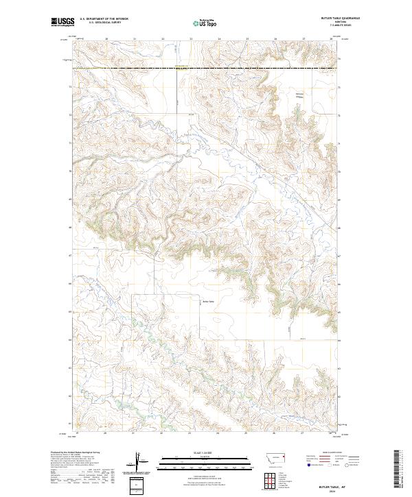
2024 Map of Butler Table
USGS Topo · Published 2024About this map
Butler Table and the elevated reaches of McCone Heights define the high ground of this Eastern Montana landscape. This territory, situated along the county line between Richland County and Dawson County, is characterized by a complex network of drainage systems that have carved deep into the plains. The headwaters of North Fork Burns Creek and Middle Fork Burns Creek converge as they flow eastward, joined by tributaries such as McGone Creek. A sparse network of rural routes, including RD 512 and RD 537, follows the natural contours of the land and section lines, providing access across the varied topography of Burns Creek country. The mapping illustrates the transition from high flat tables to the intricate coulees and breaks that define the regional geography.
Find a feature on this map
19 named features on this map. Tap any name to fly to it.
Don’t see what you’re looking for? This feature index may not catch every label — zoom into the map to look around manually.
Map Details
Editions of this 2024 Butler Table Map
This is the sole edition of this map. No revisions or reprints were ever made.
Other maps of this area

1909 · Glendive
USGS Topo · 1:250,000

1954 · Glendive
USGS Topo · 1:250,000

1957 · Glendive
USGS Topo · 1:250,000

1958 · Glendive
USGS Topo · 1:250,000

1966 · Intake NW
USGS Topo · 1:24,000

1966 · Allard Ranch
USGS Topo · 1:24,000

1972 · Red Top
USGS Topo · 1:24,000

1972 · Butler Table
USGS Topo · 1:24,000

1972 · Fox Lake
USGS Topo · 1:24,000

1972 · Enid SE
USGS Topo · 1:24,000