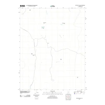
2011 Map of Butler Valley
USGS Topo · Published 2011About this map
Cottonwood Creek and Wahweap Creek carve through this high desert landscape, defining the local drainage patterns near the start of the twenty-first century. The map highlights a localized concentration of water management and naming conventions in the northwest, centered around the Butler Valley Reservoir and the Butler Valley Dam. This infrastructure sits within a larger network of named topographical depressions and flatlands, such as Round Valley and Headquarters Valley.
Find a feature on this map
14 named features on this map. Tap any name to fly to it.
Don’t see what you’re looking for? This feature index may not catch every label — zoom into the map to look around manually.
Map Details
Editions of this 2011 Butler Valley Map
This is the sole edition of this map. No revisions or reprints were ever made.
Other maps of this area

1886 · Escalante
USGS Topo · 1:250,000

1922 · Upper Last Chance
USGS Topo · 1:63,360

1955 · The Cockscob SW
USGS Topo · 1:24,000

1956 · Escalante
USGS Topo · 1:250,000

1960 · Escalante
USGS Topo · 1:250,000

1964 · Horse Flat
USGS Topo · 1:24,000

1964 · Canaan Peak
USGS Topo · 1:24,000

1964 · Death Ridge
USGS Topo · 1:24,000

1964 · Henrieville
USGS Topo · 1:24,000
1964 · Calico Peak
USGS Topo · 1:24,000