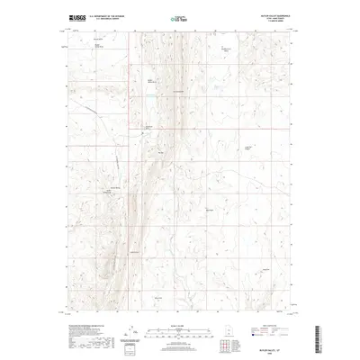
2020 Map of Butler Valley
USGS Topo · Published 2020About this map
The Cockscomb runs north-to-south through this section of Kane County, creating a sharp geological divide that defines the local drainage and settlement patterns. To its west, the basin contains Butler Valley Reservoir and the Butler Valley Neck, while the narrow passage of The Gut provides a corridor through the complex terrain. The landscape is marked by a series of named flats and valleys, including Headquarters Valley and Round Valley, which historically supported seasonal grazing and transit.
Find a feature on this map
19 named features on this map. Tap any name to fly to it.
Don’t see what you’re looking for? This feature index may not catch every label — zoom into the map to look around manually.
Map Details
Editions of this 2020 Butler Valley Map
This is the sole edition of this map. No revisions or reprints were ever made.
Other maps of this area

1886 · Escalante
USGS Topo · 1:250,000

1922 · Upper Last Chance
USGS Topo · 1:63,360

1955 · The Cockscob SW
USGS Topo · 1:24,000

1956 · Escalante
USGS Topo · 1:250,000

1960 · Escalante
USGS Topo · 1:250,000

1964 · Horse Flat
USGS Topo · 1:24,000

1964 · Canaan Peak
USGS Topo · 1:24,000

1964 · Death Ridge
USGS Topo · 1:24,000

1964 · Henrieville
USGS Topo · 1:24,000
1964 · Calico Peak
USGS Topo · 1:24,000