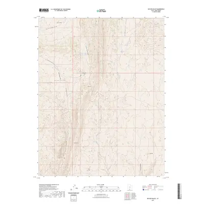
2023 Map of Butler Valley
USGS Topo · Published 2023About this map
Grosvenor Arch stands as a prominent landmark in this desert landscape of Southern Utah, where the terrain is defined by complex drainage systems and sharp ridgelines. The prominent geologic spine of The Cockscomb runs through the center of the sheet, separating the drainages of Wahweap Creek to the east from the broader depressions of Butler Valley and its narrow Butler Valley-Neck to the west. This area serves as a critical watershed, where seasonal water is managed at the Butler Valley Reservoir and found naturally at Headquarters Springs. The map reveals a network of primitive routes, primarily Cottonwood Canyon Rd, which provides access to remote landmarks like The Gut and Cods Crotch. This 2023 edition documents the modern configuration of the Grand Staircase-Escalante region, tracing high-elevation plateaus like Horse Flat and Long Flat against the deep incisions of Round Valley Draw.
Find a feature on this map
18 named features on this map. Tap any name to fly to it.
Don’t see what you’re looking for? This feature index may not catch every label — zoom into the map to look around manually.
Map Details
Editions of this 2023 Butler Valley Map
This is the sole edition of this map. No revisions or reprints were ever made.
Other maps of this area

1886 · Escalante
USGS Topo · 1:250,000

1922 · Upper Last Chance
USGS Topo · 1:63,360

1955 · The Cockscob SW
USGS Topo · 1:24,000

1956 · Escalante
USGS Topo · 1:250,000

1960 · Escalante
USGS Topo · 1:250,000

1964 · Horse Flat
USGS Topo · 1:24,000

1964 · Canaan Peak
USGS Topo · 1:24,000

1964 · Death Ridge
USGS Topo · 1:24,000

1964 · Henrieville
USGS Topo · 1:24,000
1964 · Calico Peak
USGS Topo · 1:24,000