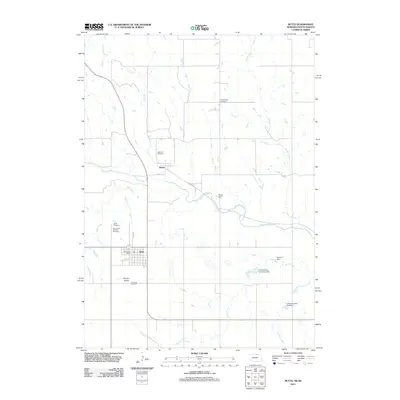
2011 Map of Butte
USGS Topo · Published 2011About this map
Butte serves as the focal point of this northern Nebraska landscape, situated near the headwaters of several local drainages. The settlement's layout is defined by thoroughfares like Thayer St and Sale Barn Dr, with the Butte Post Office anchoring the town center. The surrounding Boyd County countryside is notably dense with burial grounds, including the Old Settlers Cemetery, Lutheran Cemetery, and Saints Peter and Paul Cemetery, which highlight the area's diverse community heritage. To the north, the small settlement of Anoka sits along Railroad St, while the terrain to the south is marked by the distinctive elevation of Harvey Buttes. Water management is prominent throughout the plains, as evidenced by several engineered structures like Reiser Dam and Lampman Dam Number 1 along the various branches of Ponca Creek and Spring Creek, illustrating the region's reliance on creek-fed reservoirs for agricultural stability.
Find a feature on this map
24 named features on this map. Tap any name to fly to it.
Don’t see what you’re looking for? This feature index may not catch every label — zoom into the map to look around manually.
Map Details
Editions of this 2011 Butte Map
This is the sole edition of this map. No revisions or reprints were ever made.
Other maps of this area

1951 · Butte NW
USGS Topo · 1:24,000

1951 · Butte SW
USGS Topo · 1:24,000

1952 · Spencer South
USGS Topo · 1:24,000

1952 · Butte SE
USGS Topo · 1:24,000

1955 · Mitchell
USGS Topo · 1:250,000

1955 · O'Neill
USGS Topo · 1:250,000

1959 · O'Neill
USGS Topo · 1:250,000

1959 · Mitchell
USGS Topo · 1:250,000

1964 · Butte
USGS Topo · 1:24,000

1964 · Lake Andes SW
USGS Topo · 1:24,000