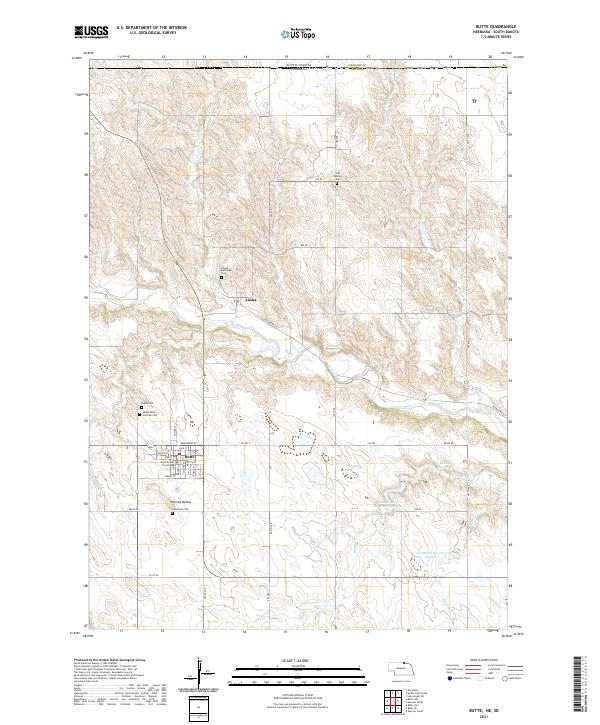
2021 Map of Butte
USGS Topo · Published 2021About this map
The Boyd County Courthouse anchors the settlement of Butte in this contemporary study of northern Nebraska, just south of the South Dakota border. The landscape is defined by the winding course of Ponca Creek and its many tributaries, including Dizzy Cr and Tobacco Cr. This area preserves significant genealogical data through a high density of local burial grounds, including the Old Settlers Cem and Anoka Lutheran Cem near the small community of Anoka. To the south, the Harvey Buttes rise above the surrounding terrain, providing a distinct geographic landmark. The map also documents an extensive network of rural water management, featuring several named bodies such as Reiman Reservoir and Lampman Reservoir Number 1. This detailed view of Boyd County illustrates the persistent agricultural and civic layout of the region, from the gridded streets of the county seat to the isolated cemeteries that mark its early history.
Find a feature on this map
49 named features on this map. Tap any name to fly to it.
Don’t see what you’re looking for? This feature index may not catch every label — zoom into the map to look around manually.
Map Details
Editions of this 2021 Butte Map
This is the sole edition of this map. No revisions or reprints were ever made.
Other maps of this area

1951 · Butte NW
USGS Topo · 1:24,000

1951 · Butte SW
USGS Topo · 1:24,000

1952 · Spencer South
USGS Topo · 1:24,000

1952 · Butte SE
USGS Topo · 1:24,000

1955 · Mitchell
USGS Topo · 1:250,000

1955 · O'Neill
USGS Topo · 1:250,000

1959 · O'Neill
USGS Topo · 1:250,000

1959 · Mitchell
USGS Topo · 1:250,000

1964 · Butte
USGS Topo · 1:24,000

1964 · Lake Andes SW
USGS Topo · 1:24,000