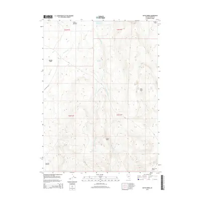
2015 Map of Butte Spring
USGS Topo · Published 2015About this map
Swedes Place and the surrounding high-desert terrain of northern Washoe County are documented in this 2015 survey, where the convergence of several minor ranges shapes the hydrological landscape. The area is defined by the Granite Range, Hog Ranch Mountains, and Butte Spring Hills, which feed a series of intermittent streams and remote watering holes. Local ranching history is evidenced by the numerous developed water sources, including Hog John Reservoir, Little Hog Ranch Reservoir, and the specifically named Bath Tub Spring.
Find a feature on this map
25 named features on this map. Tap any name to fly to it.
Don’t see what you’re looking for? This feature index may not catch every label — zoom into the map to look around manually.
Map Details
Editions of this 2015 Butte Spring Map
This is the sole edition of this map. No revisions or reprints were ever made.
Other maps of this area

1889 · Long Valley
USGS Topo · 1:250,000

1954 · Vya
USGS Topo · 1:250,000

1958 · Vya
USGS Topo · 1:250,000

1962 · Vya
USGS Topo · 1:250,000

1972 · Mahogany Mtn
USGS Topo · 1:24,000

1972 · High Rock Lake
USGS Topo · 1:24,000

1978 · Hart Mountain
USGS Topo · 1:24,000

1979 · Butte Spring
USGS Topo · 1:24,000
1979 · Chester Lyons Spring
USGS Topo · 1:24,000
1980 · Fox Mountain
USGS Topo · 1:24,000