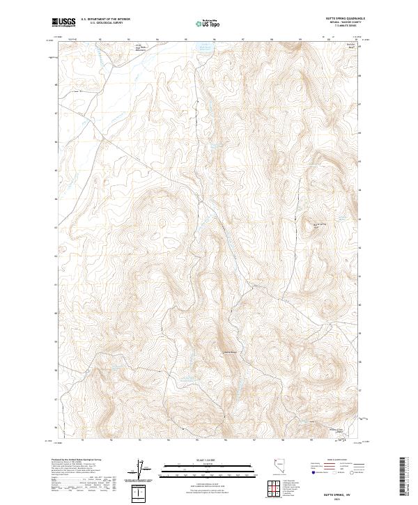
2021 Map of Butte Spring
USGS Topo · Published 2021About this map
The Little High Rock Mountains and the Granite Range dominate this high desert landscape in northwestern Nevada. Water sources are the primary points of interest in this arid region, marked by named features like Butte Spring, Bath Tub Spring, and Van Norman Springs. These springs provided vital stops for livestock and travelers in the remote Great Basin. The presence of several man-made impoundments, including the Little High Rock Reservoir, Hog John Reservoir, and Little Hog Ranch Reservoir, indicates a landscape managed for ranching and water conservation. High-clearance travel is the norm here, with C R 34 serving as the primary corridor through the terrain. The topography is further defined by the Division Range in the northeast and the deep Willow Creek Canyon in the southeast, reflecting a complex network of seasonal drainages like Hog Ranch Cr.
Find a feature on this map
23 named features on this map. Tap any name to fly to it.
Don’t see what you’re looking for? This feature index may not catch every label — zoom into the map to look around manually.
Map Details
Editions of this 2021 Butte Spring Map
This is the sole edition of this map. No revisions or reprints were ever made.
Other maps of this area

1889 · Long Valley
USGS Topo · 1:250,000

1954 · Vya
USGS Topo · 1:250,000

1958 · Vya
USGS Topo · 1:250,000

1962 · Vya
USGS Topo · 1:250,000

1972 · Mahogany Mtn
USGS Topo · 1:24,000

1972 · High Rock Lake
USGS Topo · 1:24,000

1978 · Hart Mountain
USGS Topo · 1:24,000

1979 · Butte Spring
USGS Topo · 1:24,000
1979 · Chester Lyons Spring
USGS Topo · 1:24,000
1980 · Fox Mountain
USGS Topo · 1:24,000