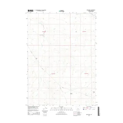
2015 Map of Butte Well
USGS Topo · Published 2015About this map
Butte Well serves as the namesake landmark for this segment of the Wyoming landscape in Fremont County. The terrain is defined by a series of significant drainage features, most notably the meandering course of Horseshoe Cr and the deeply etched path of Lame Jack Draw. These intermittent watercourses and topographic depressions, such as Signor Draw and Mahoney Draw, illustrate the complex erosion patterns common in this semi-arid region. Human presence is sparse, marked primarily by the traverse of Gas Hills Rd, which cuts diagonally across the township boundaries. To the north, Leitch Reservoir and the headwaters of Muskrat Cr provide critical water management points in an otherwise dry environment. The map captures a transition between surveyed township ranges, highlighting the intersection of local infrastructure with natural water systems like Jumping-off Draw.
Find a feature on this map
13 named features on this map. Tap any name to fly to it.
Don’t see what you’re looking for? This feature index may not catch every label — zoom into the map to look around manually.
Map Details
Editions of this 2015 Butte Well Map
This is the sole edition of this map. No revisions or reprints were ever made.
Other maps of this area

1952 · Seventy-one Reservoir
USGS Topo · 1:24,000

1952 · Squaw Butte
USGS Topo · 1:24,000

1952 · Rongis Reservoir SE
USGS Topo · 1:24,000

1952 · Double Butte
USGS Topo · 1:24,000

1952 · Haybarn Hill
USGS Topo · 1:24,000

1952 · Love Ranch
USGS Topo · 1:24,000

1952 · Rongis Reservoir
USGS Topo · 1:24,000

1952 · Puddle Springs
USGS Topo · 1:24,000

1952 · Butte Well
USGS Topo · 1:24,000

1955 · Arminto
USGS Topo · 1:250,000