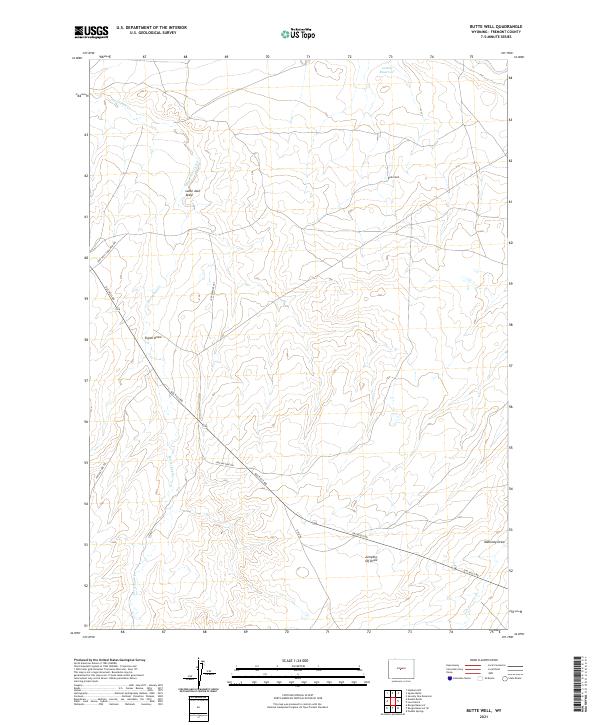
2021 Map of Butte Well
USGS Topo · Published 2021About this map
Butte Well serves as a lone landmark in this high-desert landscape of Fremont County, where the terrain is defined by a network of drainage channels and cattle-country infrastructure. The map reveals a land utilized for rangeland and transit, evidenced by the Jeep Trail Thru Pasture and the more established Gas Hills Rd cutting diagonally across the quadrangle. Water, the most precious resource in this arid environment, is managed through features like Leitch Reservoir and the winding course of Horseshoe Cr. The nomenclature of the draws—including Lame Jack Draw, Signor Draw, Jumping-off Draw, and Mahoney Draw—points to a history of ranching and local geography known to those who worked this range. This 2021 update documents the enduring layout of the Public Land Survey System against a backdrop of modern access roads like Ohio Rd.
Find a feature on this map
16 named features on this map. Tap any name to fly to it.
Don’t see what you’re looking for? This feature index may not catch every label — zoom into the map to look around manually.
Map Details
Editions of this 2021 Butte Well Map
This is the sole edition of this map. No revisions or reprints were ever made.
Other maps of this area

1952 · Seventy-one Reservoir
USGS Topo · 1:24,000

1952 · Squaw Butte
USGS Topo · 1:24,000

1952 · Rongis Reservoir SE
USGS Topo · 1:24,000

1952 · Double Butte
USGS Topo · 1:24,000

1952 · Haybarn Hill
USGS Topo · 1:24,000

1952 · Love Ranch
USGS Topo · 1:24,000

1952 · Rongis Reservoir
USGS Topo · 1:24,000

1952 · Puddle Springs
USGS Topo · 1:24,000

1952 · Butte Well
USGS Topo · 1:24,000

1955 · Arminto
USGS Topo · 1:250,000