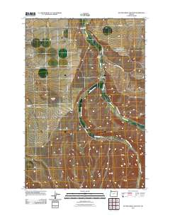
2011 Map of Butter Creek Junction
USGS Topo · Published 2011About this map
Pine City and the surrounding high desert terrain of Morrow County are documented in this 2011 survey, which illustrates a landscape defined by seasonal watercourses and remote agricultural outposts. The drainage systems of Butter Creek and Little Butter Creek carve through the region, creating named depressions like Mule Hollow and providing the geographical framework for local infrastructure. A network of rural routes, including the suggestively named Wagon Trail Rd and Pine City Rd, connects the small settlement of Butter Creek Junction to outlying landmarks. Genealogists may find particular interest in the location of the Sand Hollow Cemetery situated near the intersection of Barclay Ln, while topographical features such as Carpenter Butte provide clear navigational points across the relatively open plateaus of eastern Oregon.
Find a feature on this map
16 named features on this map. Tap any name to fly to it.
Don’t see what you’re looking for? This feature index may not catch every label — zoom into the map to look around manually.
Map Details
Editions of this 2011 Butter Creek Junction Map
This is the sole edition of this map. No revisions or reprints were ever made.
Other maps of this area

1906 · Blalock Island
USGS Topo · 1:125,000

1908 · Blalock Island
USGS Topo · 1:125,000

1908 · Umatilla
USGS Topo · 1:125,000

1953 · Pendleton
USGS Topo · 1:250,000

1956 · Pendleton
USGS Topo · 1:250,000

1968 · Service Buttes NW
USGS Topo · 1:24,000

1968 · Swaggart Buttes
USGS Topo · 1:24,000

1968 · Lena
USGS Topo · 1:24,000

1968 · Gleason Butte
USGS Topo · 1:24,000

1968 · Vey Ranch
USGS Topo · 1:24,000