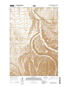
2014 Map of Butter Creek Junction
USGS Topo · Published 2014About this map
Pine City and the crossroads at Butter Creek Junction anchor this high-desert landscape in northern Oregon, where the borders of Umatilla and Morrow Counties meet. This 2014 survey illustrates the persistence of early transportation routes, including the prominent Wagon Trail Rd and Or-207, which navigate the drainages of Butter Cr and Little Butter Cr. The terrain is defined by dramatic elevation changes between the lower creek beds and high points like Carpenter Butte. This survey provides a modern view of rural infrastructure, noting a network of named local lanes such as Melville Ln, Barclay Ln, and Perkins Rd. The presence of Mule Hollow suggests the area's agricultural and ranching heritage, maintained within the township and range system through sectors like t1n r27e.
Find a feature on this map
22 named features on this map. Tap any name to fly to it.
Don’t see what you’re looking for? This feature index may not catch every label — zoom into the map to look around manually.
Map Details
Editions of this 2014 Butter Creek Junction Map
This is the sole edition of this map. No revisions or reprints were ever made.
Other maps of this area

1906 · Blalock Island
USGS Topo · 1:125,000

1908 · Blalock Island
USGS Topo · 1:125,000

1908 · Umatilla
USGS Topo · 1:125,000

1953 · Pendleton
USGS Topo · 1:250,000

1956 · Pendleton
USGS Topo · 1:250,000

1968 · Service Buttes NW
USGS Topo · 1:24,000

1968 · Swaggart Buttes
USGS Topo · 1:24,000

1968 · Lena
USGS Topo · 1:24,000

1968 · Gleason Butte
USGS Topo · 1:24,000

1968 · Vey Ranch
USGS Topo · 1:24,000