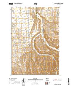
2020 Map of Butter Creek Junction
USGS Topo · Published 2020About this map
Pine City and the nearby Butter Creek Junction anchor this landscape along the border of Umatilla and Morrow Counties in north-central Oregon. The topography is defined by the drainage systems of Butter Creek and Little Butter Creek, which carve through the high plateau. The map reveals a network of rural access roads that follow the winding canyon floors and ridge lines, including the evocative Wagon Trail Road and Big Butter Creek Lane.
Find a feature on this map
21 named features on this map. Tap any name to fly to it.
Don’t see what you’re looking for? This feature index may not catch every label — zoom into the map to look around manually.
Map Details
Editions of this 2020 Butter Creek Junction Map
This is the sole edition of this map. No revisions or reprints were ever made.
Other maps of this area

1906 · Blalock Island
USGS Topo · 1:125,000

1908 · Blalock Island
USGS Topo · 1:125,000

1908 · Umatilla
USGS Topo · 1:125,000

1953 · Pendleton
USGS Topo · 1:250,000

1956 · Pendleton
USGS Topo · 1:250,000

1968 · Service Buttes NW
USGS Topo · 1:24,000

1968 · Swaggart Buttes
USGS Topo · 1:24,000

1968 · Lena
USGS Topo · 1:24,000

1968 · Gleason Butte
USGS Topo · 1:24,000

1968 · Vey Ranch
USGS Topo · 1:24,000