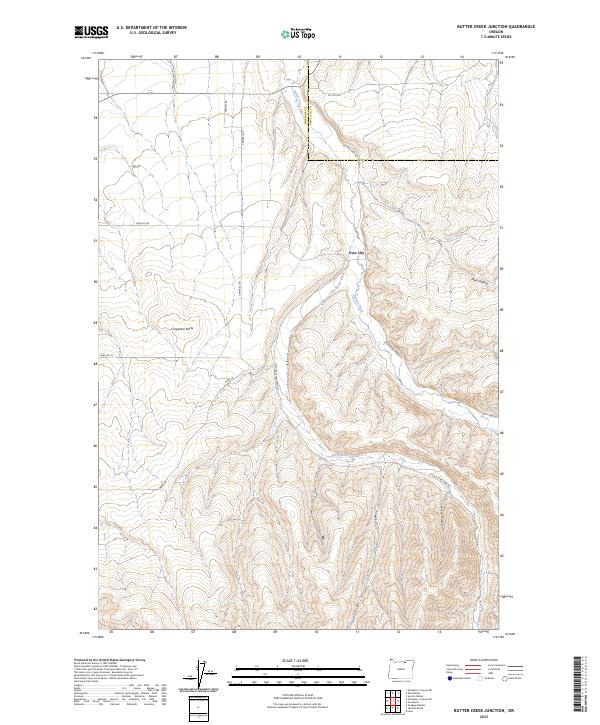
2023 Map of Butter Creek Junction
USGS Topo · Published 2023About this map
The high plateau and deep-cut drainage basins of Butter Creek characterize this region of eastern Oregon, where the landscape transitions across the Morrow Co Umatilla Co line. Central to the map is the settlement of Pine City, situated near the confluence of the main channel and Little Butter Creek. This area illustrates a classic western land-use pattern, with modern road names like Wagon Trail Rd and Campbell Rd following the straight-line section boundaries of the Public Land Survey System, while older routes like Butter Creek Rd wind naturally through the creek bottoms.
Find a feature on this map
20 named features on this map. Tap any name to fly to it.
Don’t see what you’re looking for? This feature index may not catch every label — zoom into the map to look around manually.
Map Details
Editions of this 2023 Butter Creek Junction Map
This is the sole edition of this map. No revisions or reprints were ever made.
Other maps of this area

1906 · Blalock Island
USGS Topo · 1:125,000

1908 · Blalock Island
USGS Topo · 1:125,000

1908 · Umatilla
USGS Topo · 1:125,000

1953 · Pendleton
USGS Topo · 1:250,000

1956 · Pendleton
USGS Topo · 1:250,000

1968 · Service Buttes NW
USGS Topo · 1:24,000

1968 · Swaggart Buttes
USGS Topo · 1:24,000

1968 · Lena
USGS Topo · 1:24,000

1968 · Gleason Butte
USGS Topo · 1:24,000

1968 · Vey Ranch
USGS Topo · 1:24,000