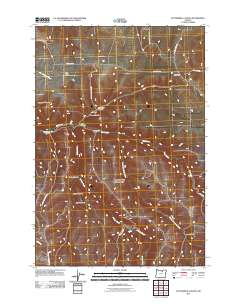
2011 Map of Buttermilk Canyon
USGS Topo · Published 2011About this map
Hale Ridge and Rood Hill define the northern uplands of this Gilliam County landscape, where a complex network of drainages has carved deep into the plateau. The topography is characterized by seasonal watercourses like Juniper Creek and the Middle Fork Rock Creek, which feed into the larger system of Rock Creek. The map reveals a series of named canyons—Buttermilk Canyon, Sweetmilk Canyon, and Harshman Canyon—suggesting a history of ranching and land use tied to these specific geographic features. Settlement patterns are sparse, represented primarily by remote thoroughfares such as Hale Bridge Rd and Buttermilk Canyon Rd, which follow the natural contours of the land. This 2011 survey captures the area's rural character, emphasizing the named hollows and canyons that have likely served as landmarks for generations of local inhabitants.
Find a feature on this map
24 named features on this map. Tap any name to fly to it.
Don’t see what you’re looking for? This feature index may not catch every label — zoom into the map to look around manually.
Map Details
Editions of this 2011 Buttermilk Canyon Map
This is the sole edition of this map. No revisions or reprints were ever made.
Other maps of this area

1953 · Pendleton
USGS Topo · 1:250,000

1956 · Pendleton
USGS Topo · 1:250,000

1968 · Gooseberry
USGS Topo · 1:24,000

1968 · Eightmile
USGS Topo · 1:24,000

1968 · Ruggs
USGS Topo · 1:24,000

1969 · Lefevre Prairie
USGS Topo · 1:24,000

1969 · Buttermilk Canyon
USGS Topo · 1:24,000
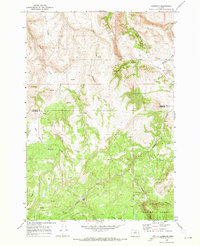
1969 · Lonerock
USGS Topo · 1:24,000

1969 · Chapin Creek
USGS Topo · 1:24,000

1969 · Hardman
USGS Topo · 1:24,000