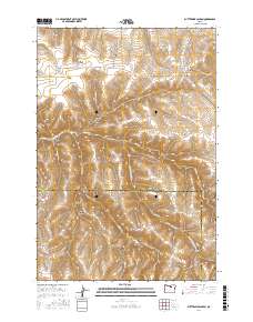
2017 Map of Buttermilk Canyon
USGS Topo · Published 2017About this map
The High Desert border between Gilliam and Morrow counties is defined by a complex network of deeply incised drainages and elevated plateaus. Hale Ridge and Rood Hill stand as prominent landmarks above a landscape carved by Rock Cr and its tributaries, including Middle Fork Rock Cr and Wick Cr. This area of north-central Oregon shows the signature patterns of dry-land geographic naming, where nearly every significant canyon and hollow carries a family name, likely reflecting early homesteaders and ranchers who managed these lands.
Find a feature on this map
34 named features on this map. Tap any name to fly to it.
Don’t see what you’re looking for? This feature index may not catch every label — zoom into the map to look around manually.
Map Details
Editions of this 2017 Buttermilk Canyon Map
This is the sole edition of this map. No revisions or reprints were ever made.
Other maps of this area

1953 · Pendleton
USGS Topo · 1:250,000

1956 · Pendleton
USGS Topo · 1:250,000

1968 · Gooseberry
USGS Topo · 1:24,000

1968 · Eightmile
USGS Topo · 1:24,000

1968 · Ruggs
USGS Topo · 1:24,000

1969 · Lefevre Prairie
USGS Topo · 1:24,000

1969 · Buttermilk Canyon
USGS Topo · 1:24,000
1969 · Lonerock
USGS Topo · 1:24,000

1969 · Chapin Creek
USGS Topo · 1:24,000

1969 · Hardman
USGS Topo · 1:24,000