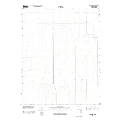
2009 Map of Buttermilk
USGS Topo · Published 2009About this map
Buttermilk sits at a crossroads in the southern Kansas prairie, a landscape defined more by its hydrologic network than by dense settlement. This 2009 survey by the U.S. Geological Survey captures the rural character of Comanche County, where the sprawling path of the Salt Fork Arkansas River cuts across the northern reaches. The area is dissected by numerous drainages, most notably Sheele Creek and Anderson Creek, which weave through the terrain and suggest the agricultural reliance on these seasonal water sources. The grid-like road system is superimposed over this winding natural drainage, reflecting the methodical land division of the Great Plains. For those researching local geography, the map provides a clear look at how the small community of Buttermilk serves as a lone anchor point amidst the wide-open ranching or farming tracts of the region.
Find a feature on this map
4 named features on this map. Tap any name to fly to it.
Don’t see what you’re looking for? This feature index may not catch every label — zoom into the map to look around manually.
Map Details
Editions of this 2009 Buttermilk Map
This is the sole edition of this map. No revisions or reprints were ever made.
Other maps of this area

1892 · Coldwater
USGS Topo · 1:125,000

1955 · Woodward
USGS Topo · 1:250,000

1955 · Pratt
USGS Topo · 1:250,000

1958 · Woodward
USGS Topo · 1:250,000

1959 · Pratt
USGS Topo · 1:250,000

1970 · Lookout
USGS Topo · 1:24,000

1970 · Freedom NW
USGS Topo · 1:24,000

1970 · Selman NW
USGS Topo · 1:24,000

1979 · Protection NE
USGS Topo · 1:24,000
1979 · Nescatunga Creek South
USGS Topo · 1:24,000