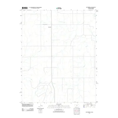
2012 Map of Buttermilk
USGS Topo · Published 2012About this map
Buttermilk serves as the primary focal point of this rural prairie landscape near the Kansas-Oklahoma border. The geography is defined by the winding course of the Salt Fork Arkansas River and its varied tributaries, which carve drainage patterns across the terrain. A network of straight-line section roads and routes such as E0010 Rd provides a geometric contrast to the natural hydrology of the region. Local watercourses including Sheele Cr and Anderson Cr highlight the drainage system that supports this agricultural area. The map illustrates the sparse settlement patterns typical of the High Plains, where small communities like Buttermilk grew around reliable water sources and essential transit corridors.
Find a feature on this map
6 named features on this map. Tap any name to fly to it.
Don’t see what you’re looking for? This feature index may not catch every label — zoom into the map to look around manually.
Map Details
Editions of this 2012 Buttermilk Map
This is the sole edition of this map. No revisions or reprints were ever made.
Other maps of this area

1892 · Coldwater
USGS Topo · 1:125,000

1955 · Woodward
USGS Topo · 1:250,000

1955 · Pratt
USGS Topo · 1:250,000

1958 · Woodward
USGS Topo · 1:250,000

1959 · Pratt
USGS Topo · 1:250,000

1970 · Lookout
USGS Topo · 1:24,000

1970 · Freedom NW
USGS Topo · 1:24,000

1970 · Selman NW
USGS Topo · 1:24,000

1979 · Protection NE
USGS Topo · 1:24,000
1979 · Nescatunga Creek South
USGS Topo · 1:24,000