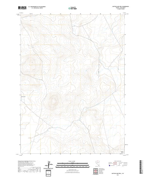
2021 Map of Button Lake Well
USGS Topo · Published 2021About this map
Owyhee Desert terrain dominates this corner of Elko County, where the landscape is defined by vast drainage networks and scattered seasonal water sources. The topography is marked by the winding path of Lake Creek, which snakes through the eastern and southern portions of the quadrangle. In the west, the isolated Button Lake provides a distinct hydrological landmark amidst the arid plains. This 2021 survey illustrates a sparse, open territory largely partitioned by the Public Land Survey System, showing the transition between various townships and ranges such as t45n r45e and t43n r45e. The lack of established roads or settlements highlights the remote character of this high-desert environment, where natural drainage and elevation contours are the primary identifiers for land navigation and historical tracking.
Find a feature on this map
12 named features on this map. Tap any name to fly to it.
Don’t see what you’re looking for? This feature index may not catch every label — zoom into the map to look around manually.
Map Details
Editions of this 2021 Button Lake Well Map
This is the sole edition of this map. No revisions or reprints were ever made.
Other maps of this area

1882 · Paradise
USGS Topo · 1:250,000

1893 · Paradise
USGS Topo · 1:250,000

1955 · McDermitt
USGS Topo · 1:250,000

1959 · McDermitt
USGS Topo · 1:250,000

1973 · McCleary Wells
USGS Topo · 1:24,000

1973 · Star Valley Ridge SW
USGS Topo · 1:24,000

1973 · Button Lake Well
USGS Topo · 1:24,000

1973 · Corral Lake
USGS Topo · 1:24,000
1973 · Star Valley Ridge SE
USGS Topo · 1:24,000

1973 · Humboldt Hill
USGS Topo · 1:24,000