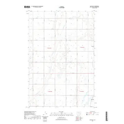
2017 Map of Buttzville
USGS Topo · Published 2017About this map
Buttzville sits at the southeastern edge of this North Dakota landscape, where the prairie is defined by the winding course of the South Branch Maple River. The terrain is marked by a grid of rural sections, with local history anchored at sites like West Saint Olaf Cem in the northeastern quadrant. The river system, labeled variously as the S Br Maple River and its full southern branch name, meanders across the flat agricultural lands, creating pockets of wetlands between the section roads. A network of local infrastructure connects these farms, primarily through routes like Co Hwy 135 and a series of numbered avenues and streets that follow the rigid Public Land Survey System grid. This map records the late-twentieth-century character of Ransom County, where the transition from open prairie to managed farmland is fully established.
Find a feature on this map
24 named features on this map. Tap any name to fly to it.
Don’t see what you’re looking for? This feature index may not catch every label — zoom into the map to look around manually.
Map Details
Editions of this 2017 Buttzville Map
This is the sole edition of this map. No revisions or reprints were ever made.
Other maps of this area

1897 · Tower
USGS Topo · 1:125,000

1953 · Fargo
USGS Topo · 1:250,000

1956 · Fargo
USGS Topo · 1:250,000

1960 · Lisbon NE
USGS Topo · 1:24,000

1960 · Enderlin South
USGS Topo · 1:24,000

1961 · Enderlin North
USGS Topo · 1:24,000

1962 · Lisbon
USGS Topo · 1:24,000

1962 · Elliott
USGS Topo · 1:24,000

1965 · Lucca
USGS Topo · 1:24,000
1967 · Nome SE
USGS Topo · 1:24,000