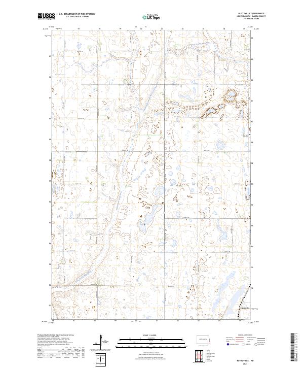
2024 Map of Buttzville
USGS Topo · Published 2024About this map
Buttzville sits at the intersection of local routes in this rural section of Ransom County, defined by the winding course of the South Branch Maple River. The landscape is a characteristic prairie grid, where section lines are traced by routes like 128th Ave SE and 55th St SE. Away from the river, the terrain is dotted with numerous small wetlands and depressions typical of the regional topography. For those researching local family history, the West Saint Olaf Cem serves as a significant landmark in the eastern portion of the quadrangle, situated just off 133 1/2 Ave SE. The presence of Co Hwy 135 in the southwest provides the primary paved connection through this agricultural landscape.
Find a feature on this map
23 named features on this map. Tap any name to fly to it.
Don’t see what you’re looking for? This feature index may not catch every label — zoom into the map to look around manually.
Map Details
Editions of this 2024 Buttzville Map
This is the sole edition of this map. No revisions or reprints were ever made.
Other maps of this area

1897 · Tower
USGS Topo · 1:125,000

1953 · Fargo
USGS Topo · 1:250,000

1956 · Fargo
USGS Topo · 1:250,000

1960 · Lisbon NE
USGS Topo · 1:24,000

1960 · Enderlin South
USGS Topo · 1:24,000

1961 · Enderlin North
USGS Topo · 1:24,000

1962 · Lisbon
USGS Topo · 1:24,000

1962 · Elliott
USGS Topo · 1:24,000

1965 · Lucca
USGS Topo · 1:24,000
1967 · Nome SE
USGS Topo · 1:24,000
Featured Places
- Liberty Township, ND
- Moore Township, ND
- Casey Township, ND
- Tuller Township, ND
- Grant Hutterite Colony, ND