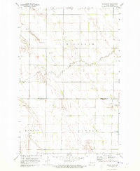
1971 Map of Buxton NW
USGS Topo · Published 1973About this map
The county boundary of Grand Forks Co Traill Co bisects this agricultural landscape, recorded during a 1971 topographic survey. The map reveals the organized township structures of Michigan, Union, Morgan, and Buxton, where a network of section roads and drainage channels like Drain supports the region's farming economy. The meandering course of Cole Creek provides one of the few natural breaks in the grid, while small-scale resource extraction is evident in several Gravel Pit sites scattered across the prairie. For those tracing local heritage, the map identifies specific community landmarks such as Calvary Cem and multiple Townhall locations, which served as civic anchors for the surrounding rural population during the early 1970s.
Find a feature on this map
11 named features on this map. Tap any name to fly to it.
Don’t see what you’re looking for? This feature index may not catch every label — zoom into the map to look around manually.
Map Details
Editions of this 1971 Buxton NW Map
This is the sole edition of this map. No revisions or reprints were ever made.
Other maps of this area

1934 · Emerado
USGS Topo · 1:48,000

1934 · Grand Forks
USGS Topo · 1:62,500

1936 · Emerado
USGS Topo · 1:62,500

1938 · Grand Forks
USGS Topo · 1:62,500

1952 · Grand Forks
USGS Topo · 1:250,000

1956 · Grand Forks
USGS Topo · 1:250,000

1963 · Emerado SE
USGS Topo · 1:24,000

1966 · Grand Forks
USGS Topo · 1:250,000
1970 · Mayville North
USGS Topo · 1:24,000
1971 · Thompson
USGS Topo · 1:24,000