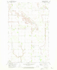
1971 Map of Buxton SW
USGS Topo · Published 1973About this map
The agricultural landscape of Traill County is defined by the township boundaries of Morgan, Buxton, Lindaas, and Wold. This 1971 survey captures a region organized around the drainage patterns of Buffalo Coulee and the N Br Goose R, with the low-lying Wold Slough marking the southeastern terrain. The map is a significant resource for genealogists, as it meticulously identifies several local burial grounds including Asheim Cem, West Immanuel Cem, Sodeberg Cem, and North Prairie Cem. Small-scale industry is evident through the numerous Gravel Pits scattered throughout the sections, while the local civic center is anchored by the Townhall located in the Wold township area.
Find a feature on this map
16 named features on this map. Tap any name to fly to it.
Don’t see what you’re looking for? This feature index may not catch every label — zoom into the map to look around manually.
Map Details
Editions of this 1971 Buxton SW Map
This is the sole edition of this map. No revisions or reprints were ever made.
Other maps of this area

1918 · Kelso
USGS Topo · 1:62,500

1943 · Kelso
USGS Topo · 1:62,500

1952 · Grand Forks
USGS Topo · 1:250,000

1956 · Grand Forks
USGS Topo · 1:250,000

1963 · Hillsboro
USGS Topo · 1:24,000

1966 · Grand Forks
USGS Topo · 1:250,000

1967 · Mayville South
USGS Topo · 1:24,000
1967 · Hillsboro NW
USGS Topo · 1:24,000
1970 · Mayville North
USGS Topo · 1:24,000
1971 · Buxton
USGS Topo · 1:24,000