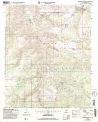
2004 Map of Buzzard Roost Mesa
USGS Topo · Published 2006About this map
Flying W Ranch and Spring Creek Ranch anchor this high-elevation landscape within the Tonto National Forest. The 2004 revision reveals a terrain defined by complex drainage systems and livestock management infrastructure, such as the North Buzzard Roost Mesa Tank and the Shipping Pasture Tank. Cattle ranching operations are evident through numerous named tanks and corrals scattered across the mesas.
Find a feature on this map
67 named features on this map. Tap any name to fly to it.
Don’t see what you’re looking for? This feature index may not catch every label — zoom into the map to look around manually.
Map Details
Editions of this 2004 Buzzard Roost Mesa Map
This is the sole edition of this map. No revisions or reprints were ever made.
Other maps of this area

1886 · Holbrook
USGS Topo · 1:250,000

1887 · Verde
USGS Topo · 1:250,000

1892 · Verde
USGS Topo · 1:250,000

1893 · Holbrook
USGS Topo · 1:250,000

1907 · Roosevelt
USGS Topo · 1:125,000

1909 · Four Peaks
USGS Topo · 1:125,000

1912 · Roosevelt
USGS Topo · 1:125,000

1922 · Chrysotile
USGS Topo · 1:125,000

1937 · Diamond Butte
USGS Topo · 1:48,000

1943 · Diamond Butte
USGS Topo · 1:62,500