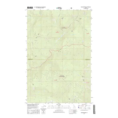
2017 Map of Buzzard Roost
USGS Topo · Published 2017About this map
The Little North Fork Clearwater River carves a deep path through the high country where the St. Joe National Forest meets the Clearwater National Forest. This remote Shoshone County terrain is defined by prominent peaks and ridges, including the lookout at Buzzard Roost and the sharp profile of Joker Peak. The map highlights a network of forest service roads and numbered tracks, such as Indian Dip Rd and Co Rd 700, which provide the only access to the area's many tributaries. Drainage patterns are intricate, with Minnesota Creek, Bear Creek, and Devils Club Creek feeding into the main river valley. Notable landmarks like the Devils Pulpit, Devils Lake, and Indian Dip name specific geological features used by foresters and hunters to navigate this wilderness along the Shoshone and Clearwater county boundary.
Find a feature on this map
66 named features on this map. Tap any name to fly to it.
Don’t see what you’re looking for? This feature index may not catch every label — zoom into the map to look around manually.
Map Details
Editions of this 2017 Buzzard Roost Map
This is the sole edition of this map. No revisions or reprints were ever made.
Other maps of this area

1914 · Avery
USGS Topo · 1:125,000

1917 · Avery
USGS Topo · 1:125,000

1923 · Washington Creek
USGS Topo · 1:125,000

1936 · Boehls Butte
USGS Topo · 1:48,000

1943 · Boehls Butte
USGS Topo · 1:62,500

1956 · Wallace
USGS Topo · 1:250,000

1956 · Hamilton
USGS Topo · 1:250,000

1959 · Hamilton
USGS Topo · 1:250,000

1960 · Wallace
USGS Topo · 1:250,000

1960 · Hamilton
USGS Topo · 1:250,000