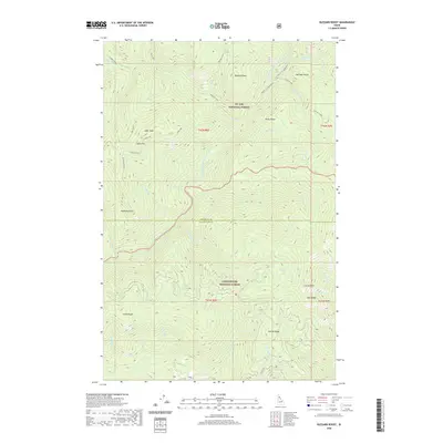
2020 Map of Buzzard Roost
USGS Topo · Published 2020About this map
St. Joe National Forest and Clearwater National Forest meet at the border of Shoshone and Clearwater Counties, creating a landscape defined by dramatic elevation changes and a dense network of mountain drainages. The Little North Fork Clearwater River winds through the center of this area, joined by numerous tributaries including Foehl Cr, Larkins Creek, and Calipeen Cr. The terrain is punctuated by distinctive high points such as Buzzard Roost, Joker Peak, and Mulligan Hump. Human passage through this steep forest is limited to primitive routes like Indian Dip Rd and Getaway Point Rd, which follow the ridgelines of Smith Ridge and Salmon Ridge. This survey captures the remote character of the Idaho Panhandle, where named features often reflect the difficulty of the land, such as Devils Pulpit and Devils Club Cr.
Find a feature on this map
47 named features on this map. Tap any name to fly to it.
Don’t see what you’re looking for? This feature index may not catch every label — zoom into the map to look around manually.
Map Details
Editions of this 2020 Buzzard Roost Map
This is the sole edition of this map. No revisions or reprints were ever made.
Other maps of this area

1914 · Avery
USGS Topo · 1:125,000

1917 · Avery
USGS Topo · 1:125,000

1923 · Washington Creek
USGS Topo · 1:125,000

1936 · Boehls Butte
USGS Topo · 1:48,000

1943 · Boehls Butte
USGS Topo · 1:62,500

1956 · Wallace
USGS Topo · 1:250,000

1956 · Hamilton
USGS Topo · 1:250,000

1959 · Hamilton
USGS Topo · 1:250,000

1960 · Wallace
USGS Topo · 1:250,000

1960 · Hamilton
USGS Topo · 1:250,000