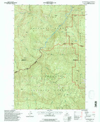
1994 Map of Buzzard Roost
USGS Topo · Published 1997About this map
St Joe National Forest and Clearwater National Forest meet in this high-elevation wilderness, defined by the rugged interface of Shoshone and Clearwater counties. The landscape is dominated by the Little North Fork Clearwater River, which carves through deep drainages between Clearwater Ridge and Goat Ridge. Notable outposts of human presence include the Chicadee Cabin near the northern boundary and Trappers Cabin tucked into the northeast corner, suggesting a history of backcountry activity in this protected region. Landmark peaks and overlooks such as Joker Peak, Buzzard Roost, and the Devils Pulpit provide significant orientation points within the Mallard Larkins Pioneer Area. This 1994 field check captures the area's intricate drainage system, including Minnesaka Creek and Honey Creek, emphasizing the region's role as a vital watershed within the National Forest system.
Find a feature on this map
43 named features on this map. Tap any name to fly to it.
Don’t see what you’re looking for? This feature index may not catch every label — zoom into the map to look around manually.
Map Details
Editions of this 1994 Buzzard Roost Map
This is the sole edition of this map. No revisions or reprints were ever made.
Other maps of this area

1914 · Avery
USGS Topo · 1:125,000

1917 · Avery
USGS Topo · 1:125,000

1923 · Washington Creek
USGS Topo · 1:125,000

1936 · Boehls Butte
USGS Topo · 1:48,000

1943 · Boehls Butte
USGS Topo · 1:62,500

1956 · Wallace
USGS Topo · 1:250,000

1956 · Hamilton
USGS Topo · 1:250,000

1959 · Hamilton
USGS Topo · 1:250,000

1960 · Wallace
USGS Topo · 1:250,000

1960 · Hamilton
USGS Topo · 1:250,000