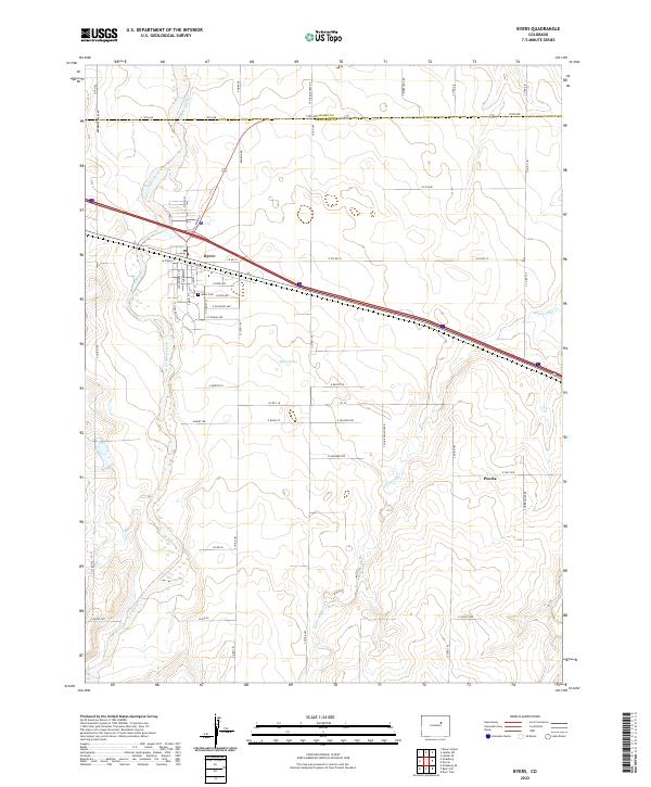
2022 Map of Byers
USGS Topo · Published 2022About this map
Byers serves as the primary hub on the eastern plains of the Arapahoe and Adams county line, where the residential grid of S Main St and E Front St meets the transit corridors crossing the semi-arid landscape. The geography is defined by the braided path of West Bijou Creek and the meandering Rattlesnake Cr, which dictate the placement of local infrastructure like the Hopewell Ditch. To the southeast, the small settlement of Peoria sits along the section lines, while landmarks such as Sheep Spring and the Byers Cem provide specific points of interest for those tracing the development of this rural community. The map illustrates a classic western grid system, with roads like Calhoun Byers Rd and Bradbury Krebs Rd marking the expansive distances between ranching and agricultural holdings.
Find a feature on this map
56 named features on this map. Tap any name to fly to it.
Don’t see what you’re looking for? This feature index may not catch every label — zoom into the map to look around manually.
Map Details
Editions of this 2022 Byers Map
This is the sole edition of this map. No revisions or reprints were ever made.
Other maps of this area

1950 · Roper School
USGS Topo · 1:24,000

1951 · Roper School
USGS Topo · 1:24,000

1951 · Leader SE
USGS Topo · 1:24,000

1952 · Leader SW
USGS Topo · 1:24,000

1953 · Denver
USGS Topo · 1:250,000

1955 · Strasburg
USGS Topo · 1:24,000

1956 · Peoria
USGS Topo · 1:24,000

1956 · Byers
USGS Topo · 1:24,000

1957 · Denver
USGS Topo · 1:250,000

1958 · Denver
USGS Topo · 1:250,000