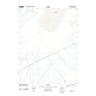
2011 Map of Byers Ranch
USGS Topo · Published 2011About this map
Byers Ranch stands as a focal point of human settlement within this remote corner of Churchill County, characterized by the expansive alluvial fans and drainage networks of the central Great Basin. The landscape is defined by the broad Edwards Creek Valley, where the intermittent flows of Edwards Creek and New Pass Creek trace seasonal paths across the desert floor toward the basin. Transportation and access in the early 21st century are facilitated by US Highway 50, which cuts a straight line through the southern portion of the quadrangle. For aviation and regional transit, the Hudson Airport provides a critical waypoint in an area otherwise dominated by the topographical shifts of Horse Canyon. The map illustrates a typical Nevada rangeland environment where isolated homesteads and essential infrastructure like small airstrips are sparse but vital landmarks.
Find a feature on this map
7 named features on this map. Tap any name to fly to it.
Don’t see what you’re looking for? This feature index may not catch every label — zoom into the map to look around manually.
Map Details
Editions of this 2011 Byers Ranch Map
This is the sole edition of this map. No revisions or reprints were ever made.
Other maps of this area

1955 · Millett
USGS Topo · 1:250,000

1959 · Millett
USGS Topo · 1:250,000

1966 · Clan Alpine Ranch
USGS Topo · 1:62,500

1966 · Edwards Creek Valley
USGS Topo · 1:62,500

1969 · Cold Springs
USGS Topo · 1:24,000

1969 · Carroll Summit NE
USGS Topo · 1:24,000

1969 · Basque Summit
USGS Topo · 1:24,000

1983 · Edwards Creek Valley
USGS Topo · 1:100,000

1985 · Smith Creek Valley
USGS Topo · 1:100,000

1990 · Byers Ranch
USGS Topo · 1:24,000