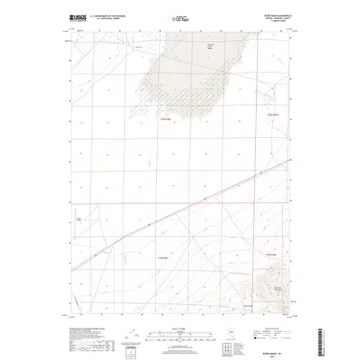
2018 Map of Byers Ranch
USGS Topo · Published 2018About this map
Byers Ranch and the expanse of the Edwards Creek Valley anchor this Churchill County landscape, where the flat valley floor meets the rising peaks of the Desatoya Mountains. The terrain transitions from the seasonal drainages of Edwards Cr and New Pass Cr in the north to the steep, complex topography of Horse Canyon in the southeast. This map captures a remote section of Nevada where aviation and historical transit paths cross. The presence of the Hudson Airport in the southwest corner suggests the importance of aerial access in this isolated basin-and-range environment. Traces of historical movement are evident along the southwestern edge, where the Old Overland Rd skirts the base of the mountains, following a corridor long utilized for travel across the Great Basin.
Find a feature on this map
12 named features on this map. Tap any name to fly to it.
Don’t see what you’re looking for? This feature index may not catch every label — zoom into the map to look around manually.
Map Details
Editions of this 2018 Byers Ranch Map
This is the sole edition of this map. No revisions or reprints were ever made.
Other maps of this area

1955 · Millett
USGS Topo · 1:250,000

1959 · Millett
USGS Topo · 1:250,000

1966 · Clan Alpine Ranch
USGS Topo · 1:62,500

1966 · Edwards Creek Valley
USGS Topo · 1:62,500

1969 · Cold Springs
USGS Topo · 1:24,000

1969 · Carroll Summit NE
USGS Topo · 1:24,000

1969 · Basque Summit
USGS Topo · 1:24,000

1983 · Edwards Creek Valley
USGS Topo · 1:100,000

1985 · Smith Creek Valley
USGS Topo · 1:100,000

1990 · Byers Ranch
USGS Topo · 1:24,000