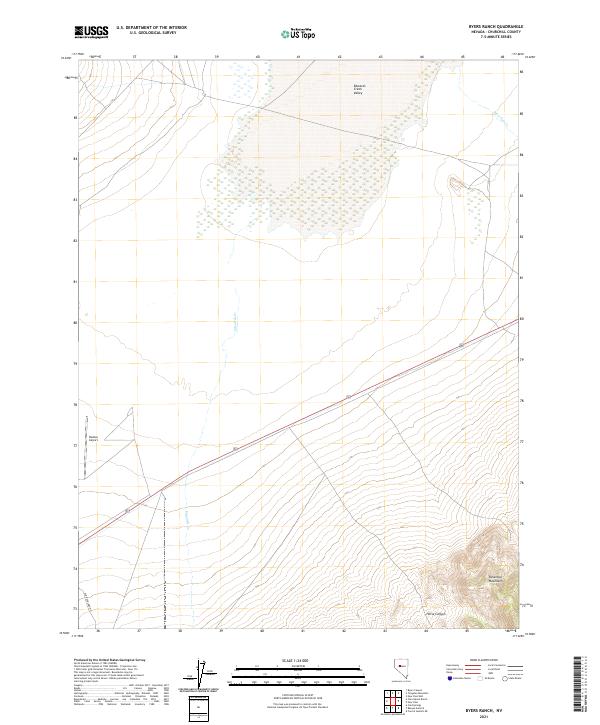
2021 Map of Byers Ranch
USGS Topo · Published 2021About this map
Edwards Creek Valley dominates this high-desert landscape in Churchill County, where seasonal watercourses like Edwards Cr and New Pass Cr define the drainage patterns of the Great Basin. To the southeast, the terrain rises sharply into the Desatoya Mountains, a prominent range marked by steep relief and features like Horse Canyon. The map preserves the alignment of the Old Overland Rd in the southwest, a route deeply tied to the historical transit corridors of the American West. This 2021 update reflects the contemporary infrastructure of the region, including the Hudson Airport, while maintaining the cadastral grid system used for land management across the vast public tracts of Nevada.
Find a feature on this map
11 named features on this map. Tap any name to fly to it.
Don’t see what you’re looking for? This feature index may not catch every label — zoom into the map to look around manually.
Map Details
Editions of this 2021 Byers Ranch Map
This is the sole edition of this map. No revisions or reprints were ever made.
Other maps of this area

1955 · Millett
USGS Topo · 1:250,000

1959 · Millett
USGS Topo · 1:250,000

1966 · Clan Alpine Ranch
USGS Topo · 1:62,500

1966 · Edwards Creek Valley
USGS Topo · 1:62,500

1969 · Cold Springs
USGS Topo · 1:24,000

1969 · Carroll Summit NE
USGS Topo · 1:24,000

1969 · Basque Summit
USGS Topo · 1:24,000

1983 · Edwards Creek Valley
USGS Topo · 1:100,000

1985 · Smith Creek Valley
USGS Topo · 1:100,000

1990 · Byers Ranch
USGS Topo · 1:24,000