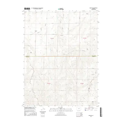
2016 Map of Byers SW
USGS Topo · Published 2016About this map
Peoria anchors the northern edge of this high plains landscape, situated within a complex network of drainage basins and rural corridors along the Arapahoe and Elbert County line. The terrain is defined by a series of intermittent waterways including Rattlesnake Cr and S Lilly Creek Ct, which have carved out distinct topographical depressions such as Mule Gulch, Hay Gulch, and Willow Gulch. The road network is primarily composed of section-line county roads and local access routes like Exmoor Rd and Palestine Rd, reflecting the underlying Public Land Survey System that shaped the agricultural development of this region. A notable local landmark is the uniquely named Happy Butt Airport, located near Knudtson Rd. In the south, the landscape transitions toward Station Gulch, illustrating the sparse, ranch-oriented settlement pattern of eastern Colorado in the early 21st century.
Find a feature on this map
38 named features on this map. Tap any name to fly to it.
Don’t see what you’re looking for? This feature index may not catch every label — zoom into the map to look around manually.
Map Details
Editions of this 2016 Byers SW Map
This is the sole edition of this map. No revisions or reprints were ever made.
Other maps of this area

1953 · Denver
USGS Topo · 1:250,000

1955 · Strasburg
USGS Topo · 1:24,000

1956 · Peoria
USGS Topo · 1:24,000

1956 · Byers
USGS Topo · 1:24,000

1957 · Denver
USGS Topo · 1:250,000

1958 · Denver
USGS Topo · 1:250,000

1960 · Denver
USGS Topo · 1:250,000

1968 · Deer Trail
USGS Topo · 1:24,000
1969 · Strasburg SE
USGS Topo · 1:24,000
1969 · Deer Trail
USGS Topo · 1:24,000