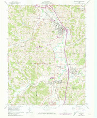
1961 Map of Byesville
USGS Topo · Published 1973About this map
Strip mines and Oil Wells mark the hills of southern Guernsey County, where industrial extraction defines the landscape between the North Boundary Military District and the South Boundary Congress Lands. The mining operations are concentrated north of Byesville, where a network of haul roads and excavations surrounds the Beech Grove Sch. Heavy industry sits alongside community life, with the Drive-in Theater and Golf Course positioned near the Wills Creek floodplain. In the southern portion of the quadrangle, the Seneca Fork Wills Creek winds through the Valley, connecting the settlements of Pleasant City and Buffalo. This area is a hub for rail transport, featuring the Penn Central and the Baltimore and Ohio Railroad, as well as an Old Railroad Grade that hints at earlier transportation corridors. Local genealogy is well-represented through numerous burial grounds like Mt Zion Cem, Mt Calvary Cem, and St Michaels Cem.
Find a feature on this map
51 named features on this map. Tap any name to fly to it.
Don’t see what you’re looking for? This feature index may not catch every label — zoom into the map to look around manually.
Map Details
Editions of this 1961 Byesville Map
4 editions found
Other maps of this area

1909 · Antrim
USGS Topo · 1:48,000

1909 · Summerfield
USGS Topo · 1:62,500

1909 · Cambridge
USGS Topo · 1:62,500

1911 · Antrim
USGS Topo · 1:62,500

1911 · Cumberland
USGS Topo · 1:62,500

1911 · Summerfield
USGS Topo · 1:62,500

1912 · Cambridge
USGS Topo · 1:62,500

1949 · Clarksburg
USGS Topo · 1:250,000

1951 · Canton
USGS Topo · 1:250,000

1953 · Canton
USGS Topo · 1:250,000