1987 Map of Bynum
USGS Topo · Published 1987About this map
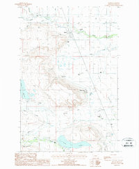
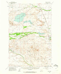
Bynum stands at the center of this Teton County landscape, where the managed waters of the Rocky Mountain Front meet the plains. The 1980s terrain is defined by a sophisticated network of irrigation, including a Flume, Inverted Siphon, and various named ditches that feed Farmers Reservoir and the large Eureka Reservoir. This infrastructure supports a distinct pattern of settlement, from the clustered structures of the Miller Colony to numerous family-held spreads like Monkman Ranch, Fabrick Ranch, and Blixrud Ranch. The topographic detail reveals the sharp rise of Burton Bench and the winding course of the Teton River in the south. Aviation and industry are represented by a Landing Strip and several Gravel Pits, while the presence of an Aband Canal near the Muddy Creek drainage points to the shifting history of water management in this agricultural corridor.
Find a feature on this map
42 named features on this map. Tap any name to fly to it.
Don’t see what you’re looking for? This feature index may not catch every label — zoom into the map to look around manually.
Map Details
Editions of this 1987 Bynum Map
This is the sole edition of this map. No revisions or reprints were ever made.
Other maps of this area

1920 · Choteau
USGS Topo · 1:125,000
1920 · Dupuyer
USGS Topo · 1:125,000
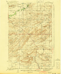
1936 · Pendroy
USGS Topo · 1:48,000
1938 · Gallup City
USGS Topo · 1:62,500
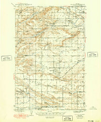
1941 · Pendroy
USGS Topo · 1:62,500
1942 · Gallup City
USGS Topo · 1:62,500

1955 · Choteau
USGS Topo · 1:250,000

1957 · Choteau
USGS Topo · 1:250,000

1958 · Choteau
USGS Topo · 1:250,000
1960 · Bynum
USGS Topo · 1:62,500