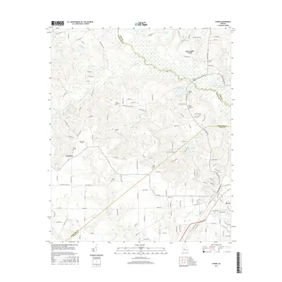
2017 Map of Byron
USGS Topo · Published 2017About this map
Byron and the smaller settlement of Friendship serve as anchors for this central Georgia landscape where Bibb, Crawford, and Peach counties meet. The area is defined by a dense network of family-named burial grounds, providing a significant resource for genealogical research with sites such as the Waldron Cem, Nimrod Jackson Cem, and the Brown-Hallman Family Cem. These sites are scattered across a terrain drained by Echeconnee Creek and its many tributaries, including Sandhill Cr and Deep Cr.
Find a feature on this map
141 named features on this map. Tap any name to fly to it.
Don’t see what you’re looking for? This feature index may not catch every label — zoom into the map to look around manually.
Map Details
Editions of this 2017 Byron Map
This is the sole edition of this map. No revisions or reprints were ever made.
Other maps of this area

1956 · Fort Valley
USGS Topo · 1:62,500

1956 · Bolingbroke
USGS Topo · 1:62,500

1956 · Warner Robins
USGS Topo · 1:62,500

1956 · Macon West
USGS Topo · 1:24,000

1956 · Macon
USGS Topo · 1:62,500

1957 · Macon
USGS Topo · 1:250,000

1958 · Macon
USGS Topo · 1:250,000

1964 · Macon
USGS Topo · 1:250,000
1973 · Fort Valley West
USGS Topo · 1:24,000
1973 · Warner Robins SW
USGS Topo · 1:24,000