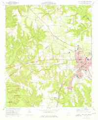
1973 Map of Fort Valley West
USGS Topo · Published 1976About this map
The agricultural and academic hub of Fort Valley dominates the eastern half of this 1970s landscape, centered on the campus of Fort Valley State College and the intersection of the Southern and Central of Georgia railroads. This era of the Georgia heartland is characterized by a dense network of country churches and family burial grounds, including Ross Chapel Cem, Harris Chapel Cem, and Benevolence Ch, which anchor the surrounding rural communities. The terrain transitions from the developed streets of the city out to dispersed settlements like Zenith, Lee Pope, and Nakomis. Local infrastructure of the day is well-documented, from the Landing Strip and Radio Tower (WFPM) to the County Hospital and numerous neighborhood schools like the Hunt Sch, reflecting the civic growth of Peach and Crawford counties.
Find a feature on this map
59 named features on this map. Tap any name to fly to it.
Don’t see what you’re looking for? This feature index may not catch every label — zoom into the map to look around manually.
Map Details
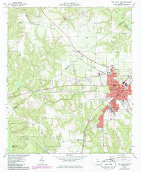
Editions of this 1973 Fort Valley West Map
2 editions found
Other maps of this area

1955 · Phenix City
USGS Topo · 1:250,000

1956 · Fort Valley
USGS Topo · 1:62,500

1957 · Phenix City
USGS Topo · 1:250,000

1957 · Macon
USGS Topo · 1:250,000

1958 · Macon
USGS Topo · 1:250,000

1958 · Phenix City
USGS Topo · 1:250,000

1964 · Macon
USGS Topo · 1:250,000

1971 · Reynolds
USGS Topo · 1:24,000
1971 · Roberta
USGS Topo · 1:24,000

1971 · Garden Valley
USGS Topo · 1:24,000