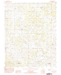
1984 Map of Byron
USGS Topo · Published 1984About this map
The Strawberry River and its numerous tributaries, including Ross Branch and Cochran Branch, define the rural landscape along the border of Fulton and Izard Counties. Small communities like Byron and Bexar serve as local hubs in this upland terrain, which is dotted with isolated landmarks such as Mt Pleasant and Shady Grove. The map records a series of established burial grounds, including Liberty Cem and Talley Cem, which provide essential touchpoints for genealogical research in this part of Arkansas. The road network connects these small settlements through valleys shaped by Greasy Creek and Markleroad Creek, revealing a settlement pattern where homes and small churches, such as the one at Union, are oriented toward the many creek crossings and a local Gravel Pit.
Find a feature on this map
23 named features on this map. Tap any name to fly to it.
Don’t see what you’re looking for? This feature index may not catch every label — zoom into the map to look around manually.
Map Details
Editions of this 1984 Byron Map
This is the sole edition of this map. No revisions or reprints were ever made.
Other maps of this area

1890 · Mountain Home
USGS Topo · 1:125,000

1891 · Mountain Home
USGS Topo · 1:125,000

1894 · Mountain Home
USGS Topo · 1:125,000

1945 · Harrison
USGS Topo · 1:250,000

1949 · Harrison
USGS Topo · 1:250,000

1950 · Salem
USGS Topo · 1:62,500

1951 · Salem
USGS Topo · 1:62,500

1951 · Melbourne
USGS Topo · 1:62,500

1954 · Harrison
USGS Topo · 1:250,000

1957 · Poplar Bluff
USGS Topo · 1:250,000