
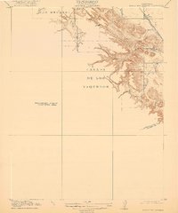
1916 Map of Byron Hot Springs
USGS Topo · Published 1916About this map
Byron Hot Springs sits at the foot of the hills in eastern Contra Costa County, a destination reachable by the Southern Pacific railroad during the early twentieth century. This survey, a Preliminary Edition, reveals the contrast between the organized settlement of Byron and the sprawling land grants of Los Meganos and Canada De Los Vaqueros. The terrain is defined by the drainage patterns of Kellogg Creek and Brushy Creek, which carve through the rising elevations toward the south.
Find a feature on this map
9 named features on this map. Tap any name to fly to it.
Don’t see what you’re looking for? This feature index may not catch every label — zoom into the map to look around manually.
Map Details
Editions of this 1916 Byron Hot Springs Map
2 editions found
Other maps of this area

1896 · Mt. Diablo
USGS Topo · 1:62,500

1898 · Mt. Diablo
USGS Topo · 1:62,500

1906 · Pleasanton
USGS Topo · 1:62,500

1907 · Tesla
USGS Topo · 1:62,500

1911 · Byron Hot Springs
USGS Topo · 1:31,680

1913 · Woodward Island
USGS Topo · 1:31,680

1914 · Brentwood
USGS Topo · 1:31,680

1914 · Bethany
USGS Topo · 1:31,680

1916 · Lone Tree Valley
USGS Topo · 1:31,680

1916 · Byron
USGS Topo · 1:62,500