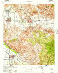
1956 Map of Cabazon
USGS Topo · Published 1987About this map
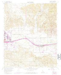
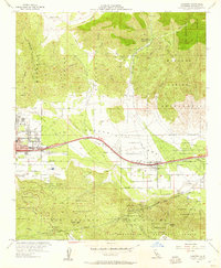
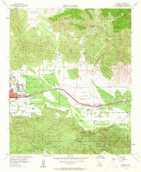
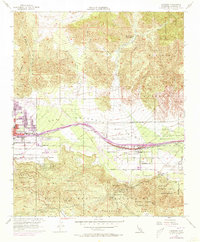
The Morongo Indian Reservation dominates this mid-century landscape, framing the development of Banning and Cabazon along the critical transport corridor of the Southern Pacific railroad. The map illustrates a complex water and infrastructure network necessary for desert habitation, notably featuring the Colorado River Aqueduct and the San Gorgonio River. While the urban centers show emerging residential streets like Ramsey St and Nicolet St, the surrounding terrain remains defined by rugged canyons such as Millard Canyon and prominent landmarks like Barker Peak. Notable local infrastructure includes the Banning Airport, a Riverside Co Road Camp, and various guarding stations, providing a detailed look at the public works and civic boundaries of the era. Smaller features such as a Quarry, Gravel Pit, and a Cem offer specific points of interest for local history and genealogy.
Find a feature on this map
43 named features on this map. Tap any name to fly to it.
Don’t see what you’re looking for? This feature index may not catch every label — zoom into the map to look around manually.
Map Details
Editions of this 1956 Cabazon Map
5 editions found

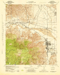
Other maps of this area

1901 · Southern California Sheet No. 1
USGS Topo · 1:250,000

1901 · San Jacinto
USGS Topo · 1:125,000

1902 · San Gorgonio
USGS Topo · 1:125,000

1904 · Southern California Sheet No. 1
USGS Topo · 1:250,000

1940 · Palm Springs
USGS Topo · 1:62,500

1942 · Banning
USGS Topo · 1:62,500
1943 · Banning
USGS Topo · 1:62,500
1944 · Palm Springs
USGS Topo · 1:62,500

1947 · Santa Ana
USGS Topo · 1:250,000

1949 · Santa Ana
USGS Topo · 1:250,000