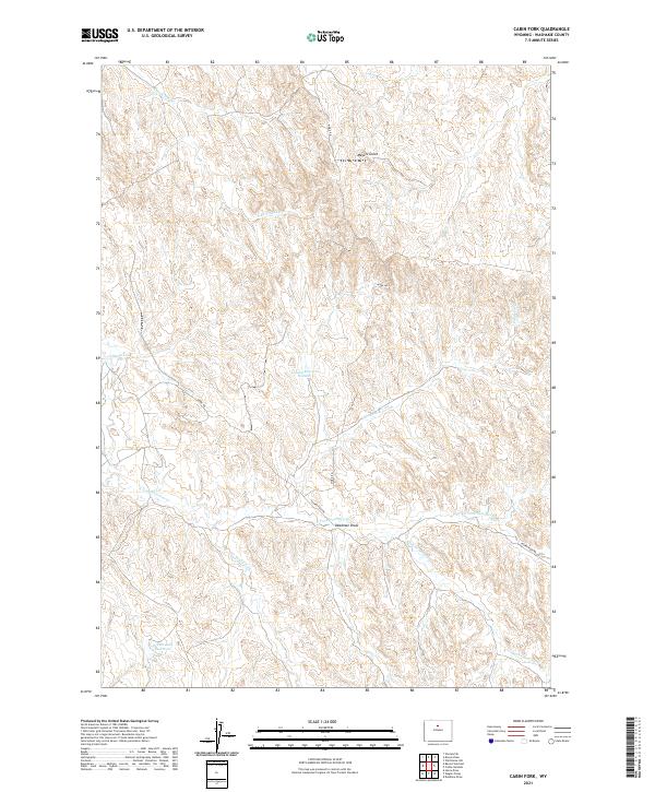
2021 Map of Cabin Fork
USGS Topo · Published 2021About this map
Intermittent drainages and seasonal water storage define this arid reach of Washakie County, where the high desert landscape is etched by long-distance draws and ephemeral forks. The namesake Cabin Fork and Joe Henry Fork converge in a region shaped by modern resource management, as seen at the Lyman Reservoir Number 1 and the Denver Jake Reservoir. These catchment features are critical in a terrain defined by labels like Deadman Draw and Meyers Gulch, where water is a transient but powerful architect of the land.
Find a feature on this map
18 named features on this map. Tap any name to fly to it.
Don’t see what you’re looking for? This feature index may not catch every label — zoom into the map to look around manually.
Map Details
Editions of this 2021 Cabin Fork Map
This is the sole edition of this map. No revisions or reprints were ever made.
Other maps of this area

1955 · Sheridan
USGS Topo · 1:250,000

1955 · Arminto
USGS Topo · 1:250,000

1958 · Sheridan
USGS Topo · 1:250,000

1958 · Arminto
USGS Topo · 1:250,000

1962 · Sheridan
USGS Topo · 1:250,000

1962 · Arminto
USGS Topo · 1:250,000

1966 · Deadline Draw
USGS Topo · 1:24,000

1966 · Cabin Fork
USGS Topo · 1:24,000

1966 · Wagon Prong
USGS Topo · 1:24,000
1966 · Henry Draw
USGS Topo · 1:24,000